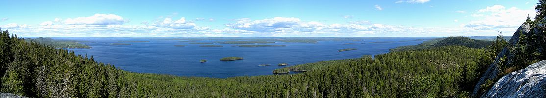
 Lake Pielinen seen from a hill in Koli National Park.
 Repovesi National Park in southeastern Finland. <<
Finland is a country of thousands of lakes and islands – 187,888 lakes (larger than 500 m2/0.12 acres) and 179,584 islands. Its largest lake, Saimaa, is the fourth largest in Europe. The Finnish landscape is mostly flat with few hills, and its highest point, the Halti at 1,324 metres (4,344 ft), is found in the extreme north of Lapland at the border between Finland and Norway. Forest covers 86% of the country's area the largest forested area in Europe. The forest consists of pine, spruce, birch, larch and other species. Finland is the largest producer of wood in Europe and among the largest in the world.
The landscape is covered mostly (seventy-five percent of land area) by coniferous taiga forests and fens, with little arable land. The most common type of rock is granite. It is a ubiquitous part of the scenery, visible wherever there is no soil cover. Moraine or till is the most common type of soil, covered by a thin layer of humus of biological origin. Podzol profile development is seen in most forest soils except where drainage is poor. Gleysols and peat bogs occupy poorly drained areas. The greater part of the islands are found in the southwest in the Archipel ago Sea, part of the archipelago of the Åland Islands, and along the southern coast in the Gulf of Finland.
Finland is one of the few countries in the world whose surface area is still expanding. Owing to the post-glacial rebound that has been taking place since the last ice age, the surface area of the country is expanding by about 7 square kilometres (2.70 sq mi) annually.
The distance from the southernmost – Hanko – to the northernmRepovesi National Park in southeastern Finland.
 ost point in the country – Nuorgam – is 1,445 kilometres (898 miles).
Ei kommentteja:
Lähetä kommentti